Thinking about a lakefront home in Excelsior and picturing a new pool, an expanded deck, or a light-filled addition? Before you fall in love with a plan, make sure the land will allow it. On Lake Minnetonka, shoreline setbacks, easements, and the true property lines can limit where you build and how you use your site. In this guide, you’ll learn what the right survey reveals, how OHWL-based setbacks work, and how easements can reshape a project so you can move forward with confidence. Let’s dive in.
What a survey shows on lakeshore lots
The survey you order sets the tone for everything that follows. An ALTA/NSPS Land Title Survey focuses on title-related details and typically maps recorded easements, visible improvements, and encroachments. A boundary survey concentrates on precisely locating your property lines and where existing structures sit relative to those lines. Many lake buyers combine boundary, topographic mapping, and an OHWL determination to see the true buildable area.
ALTA/NSPS highlights for lakeshore
An ALTA/NSPS survey identifies property boundaries, shows visible improvements like homes, garages, decks, fences, and retaining walls, and references recorded easements and rights-of-way listed in the title work. It can also show roads, alleys, and utility features where visible or in public record. Optional items, often called Table A items, can add utility locations, FEMA flood data, and water-related information that matter near the shoreline.
Boundary and topo essentials
A boundary survey gives you the exact corners and lines, which is crucial before designing an addition or pool. Adding topography shows contours and spot elevations so you can plan grading, drainage, and realistic footprints. For lakeshore parcels, request the surveyor to locate the Ordinary High-Water Level, or OHWL, and measure distances from that line to existing and proposed improvements.
Know your survey’s limits
Surveyors rely on recorded documents and field evidence. Subsurface utilities are not automatically shown and often require a separate utility locate. ALTA surveys do not include topography, OHWL, or wetland boundaries unless you request them as added scope or Table A items. If wetlands or public waters questions arise, bring in the right specialists to confirm boundaries and permitting needs.
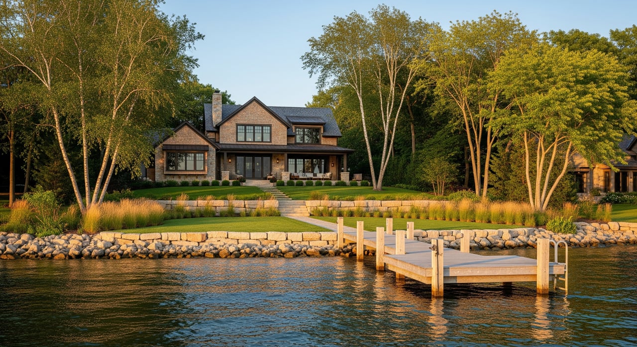
Shoreline setbacks and OHWL in Excelsior
Shoreline rules start with the OHWL, a line based on physical evidence and elevation that state guidance defines and local ordinances use for measuring setbacks. Minnesota’s shoreland rules establish statewide minimums, and cities like Excelsior adopt their own shoreland ordinances that can be more restrictive. Your parcel’s zoning, lot size, and whether it has sewer service can all influence the setback and coverage limits.
Why OHWL placement matters
The OHWL often reduces the buildable area more than you expect, especially on irregular lots. Even a few feet can decide whether a pool or addition fits without a variance. Ask your surveyor to field-delineate the OHWL and show clear dimensions to structures so your designer can draw within the limits.
Setback basics to confirm locally
Many Minnesota shoreland districts use structure setbacks measured from the OHWL, and 50 feet is a common baseline in many codes, though the actual requirement varies by district and lot conditions. Accessory items like low decks, patios, or paths are often treated differently than habitable structures. Vegetation buffers, shoreline alterations, and retaining walls are usually regulated and may require permits or specific materials.
Nonconformities and expansion
Some existing homes or decks sit closer to the shore than today’s rules allow. These nonconforming structures may remain, but expanding them usually triggers compliance with current setbacks or a variance process. Plan ahead with the City of Excelsior so you understand what is possible before you commit to a design or an offer.
Easements that can reshape your plan
Easements and rights-of-way can be just as limiting as setbacks. They often dictate where you can build, dig, and even how you access the water. Your title commitment and survey together reveal these constraints.
Common easement types on Lake Minnetonka
- Utility easements for power, water, sewer, gas, and communications that often prohibit permanent structures within the easement area.
- Public access or pedestrian easements that allow others to cross a portion of the lot to reach the shoreline.
- Drainage or conservation easements that limit grading, fill, and vegetation removal.
- Private covenants or lake association rules that add restrictions on docks, exterior finishes, and impervious surface beyond public codes.
How easements affect projects
A pool, addition, or retaining wall cannot sit inside an active utility easement without the holder’s approval, which is rarely granted. Even narrow easements can block access, trenching, or the safest route for utilities. If a structure already encroaches into an easement, it can create title risk, and you may be asked to remove or modify it during permitting or refinancing.
Where to verify easements
Expect recorded easements to appear in the preliminary title commitment, which your surveyor will map when documents are available. Hennepin County property records, City of Excelsior planning or engineering, and utility providers can help confirm scope and location, including any unrecorded agreements. Your title company and a survey that includes the right Table A items provide the clearest picture.
A practical due diligence plan
A simple plan can save you from costly redesigns and delays. Start early, get the right scope, and align the city, surveyor, and your design team.
Who to involve and when
- Licensed land surveyor: order an ALTA/NSPS or boundary survey with Table A items for OHWL, topography, utilities, and flood mapping as needed.
- Civil engineer or site designer: evaluate grading, drainage, and septic feasibility, and test-fit pools or additions.
- City of Excelsior planning and building: confirm setbacks, vegetation rules, impervious limits, and whether you need permits or a variance.
- Title company or real estate attorney: review recorded easements and exceptions.
- Minnesota DNR or a wetland professional: consult if shoreline work or wetlands are in play.
- Utility providers: request utility locations and any easement constraints.
What to include in your survey scope
- Monumented corners with coordinates.
- OHWL located, marked, and dimensioned to improvements.
- Existing structures mapped with distances to property lines and the OHWL.
- Topographic contours at a usable interval, often 1 to 2 feet.
- Locations of septic, well, drainfields, and visible utility features.
- FEMA floodplain and base flood information when applicable.
- All recorded easements, rights-of-way, and platted setbacks, plus any encroachments.
- Relevant Table A items for utilities, contours, water boundaries, flood data, and wetlands.
Timing and offer strategy
Order the survey during due diligence, or earlier if the market is competitive and you are comfortable investing upfront. Typical turnaround is 1 to 4 weeks depending on scope and season. Winter conditions can complicate OHWL and topo work, so plan accordingly. Use the results to shape your offer, contingency terms, and design budget.
Questions to answer before offering
- Where is the OHWL and how much buildable area remains landward of that line?
- Which recorded easements or covenants could block a pool, addition, or new dock configuration?
- What setbacks, buffers, and impervious limits apply on this specific parcel in Excelsior?
- Will the work need DNR, city, or county permits, or a variance?
- Do any existing features encroach on a neighbor, a public right-of-way, or an easement?
- Are there septic or soil constraints that limit bedrooms or occupancy?
The bottom line for Excelsior buyers
On Lake Minnetonka, success starts with clarity on the land. The right survey, a confirmed OHWL, and a thorough review of easements help you design within the rules and protect your investment. Engage your surveyor and the City of Excelsior early, then design with confidence knowing what the site will support. If you want a development-minded partner who can coordinate surveys, pre-application steps, and builder conversations, connect with the Steadman Team to request a private consultation and valuation.
FAQs
What survey should I order for an Excelsior lakeshore lot?
- An ALTA/NSPS survey with Table A items plus topography and an OHWL determination gives the clearest picture; a boundary survey can work if you add OHWL and topo.
What is OHWL and why does it matter for my project?
- The Ordinary High-Water Level is the legal line many setbacks use, and its location can change your buildable area and whether a pool or addition fits without a variance.
Can I expand a deck or home that sits inside today’s shoreline setback?
- Existing nonconforming structures may remain, but expansions usually must meet current rules or go through a variance process confirmed by the city.
How do easements show up during due diligence?
- Recorded easements appear as exceptions in the title commitment and should be mapped on the survey; unrecorded agreements may surface through city or utility inquiries.
Who regulates docks and shoreline work on Lake Minnetonka?
- Both state and local authorities play a role, with public waters oversight at the state level and additional city or lake rules for docks, moorings, and shoreline changes.
What if my planned pool overlaps a utility easement?
- Utility holders typically prohibit permanent structures in their easements, so you will need to relocate the pool, redesign, or seek an easement change that is rarely granted.